

|
|
Site 44JC308, PaspaheghSite 44JC308, also known as Paspahegh, is one of only a handful of excavated Native American villages in Virginia which date to the Early Contact Period. Located just six miles upstream of Jamestown, the site provides a unique opportunity to understand how direct contact with European colonists affected the native societies of the Virginia Coastal Plain. The people living at the site were Powhatan Indians, Algonquians living in chiefdoms subject to the ruler Powhatan. As subjects of Powhatan and neighbors to the English, the residents of 44JC308 undoubtedly were involved in the exchange of goods and violence that characterized the first years of the Jamestown colony.Site 44JC308 was first identified in 1983 by archaeological surveyors from the College of William and Mary's Department of Anthropology. When construction threatened the site in the early 1990s, archaeologists from the James River Institute for Archaeology (JRIA) conducted controlled surface collections across the approximately 31 acre site, later returning to excavate within a 2.1 acre parcel in the southwestern portion of 44JC308. The information on this website is drawn primarily from JRIA's 1994 report of these excavations: "Paspahegh Archaeology: Data Recovery Investigations of Site 44JC308 at the Governor's Land at Two Rivers, James City County, Virginia," edited by Mary Ellen Hodges and Charles Hodges. |
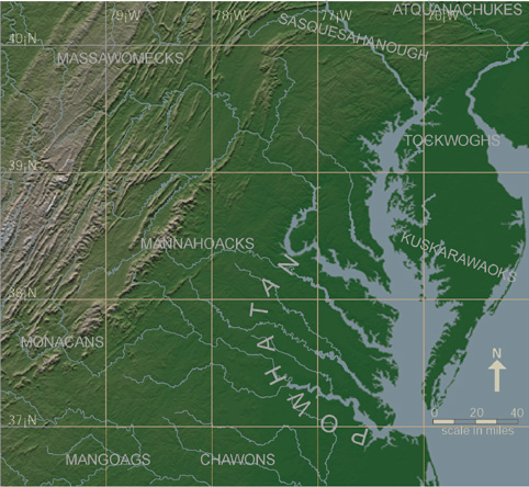 Larger version of tribal territories map |
44JC308 in ContextThe site is located on the east bank of the Chickahominy River one-third of a mile north of its confluence with the James, an area identified by Captain John Smith as belonging to the Paspahegh Indians, a group subject to Powhatan. The Paspahegh were one of at least 31 named, territorial groups within Powhatan's territory, all but one of which (the Chickahominy) were subject to Powhatan at 1607. The names and locations of the 31 groups can be viewed here.Both Smith's map of 1612 and the Zuniga map (believed to be a copy of Smith's 1608 map sent by the Spanish ambassador to the English, Don Pedro de Zuniga, to King Phillip III of Spain) indicate that the Paspahegh were settled along the north bank of the James, between Jamestown Island and the area west of the confluence of the James and the Chickahominy rivers. Their location at the confluence of these two important rivers is likely responsible for the name "Paspahegh," believed by linguists to be Algonquian for "at the mouth of [a stream]" (Rountree 1989:11). Smith's 1612 map shows two villages east of the Chickahominy, one of which may be labeled "Matapanient." The two villages are labeled Namqosick and Cinquaoteck on the Zuniga map. Smith's map also shows three villages west of the Chickahominy-James confluence, including one "kings howse," the residence of the chief of the Paspahegh. Nearby settlements include Chickahominy villages further along the river of the same name and villages directly across the James from the Paspaheghs inhabited by the Quiyoughcohannock. |
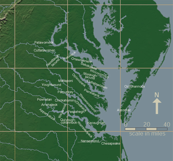 View larger version of petty chiefdoms map 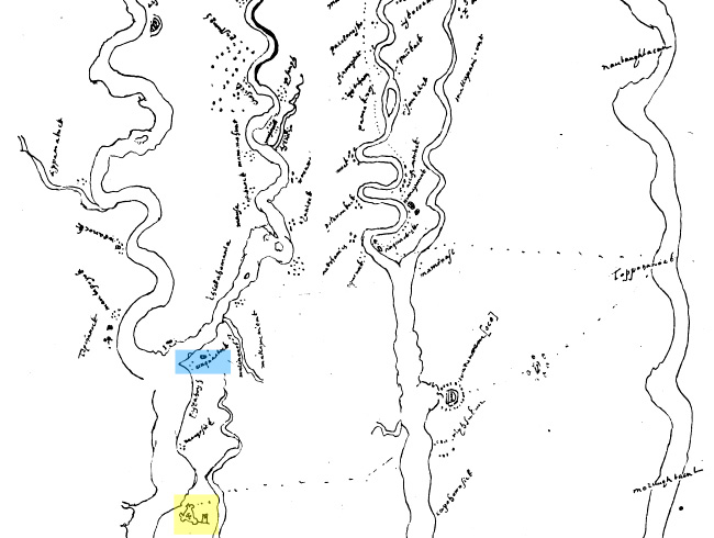 View larger version of Zuniga map 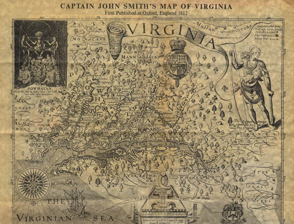 View larger version of Smith map |
History of the Paspahegh and English InteractionWhen Captain John Smith and his fellow colonists selected their seasonal hunting groundson Jamestown Island for the site of their fort, the Paspahegh became the first victim of English expansion in the Chesapeake. The Paspahegh were the primary representatives of the Powhatan in the first months of the colony, and thus were key players in the process of mutual appraisal, violence, and wary alliance that characterized Powhatan-English relations durinfg the early contact period. As their nearest neighbors on the James, the Paspahegh made convenient trading partners to the English, but also were convenient military targets when an offense against the colonists had to be punished. Their losses in the early days of the First Anglo-Powhatan War in 1611 appear to have led to the abandonment of Paspahegh territory and the demise of the Paspahegh as a named group. View a timeline of the Paspehegh interaction with the English. |
|
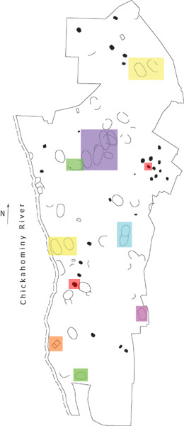
Examining the SiteYou may click the shaded areas on the map to be linked to a close-up site-drawing of that area, as well as further information related to the type of structure it is presumed to be. Or, you may choose a topic from the list below. Additional Information About Features
Additional Information About Artifacts |
|